
The Erosion filter simulates the erosion of the terrain by thousands or millions of years of weathering by rain and flowing water. It is an exceptionally useful tool to add detail and realism to human-created terrains, and belongs in almost any World Machine world.
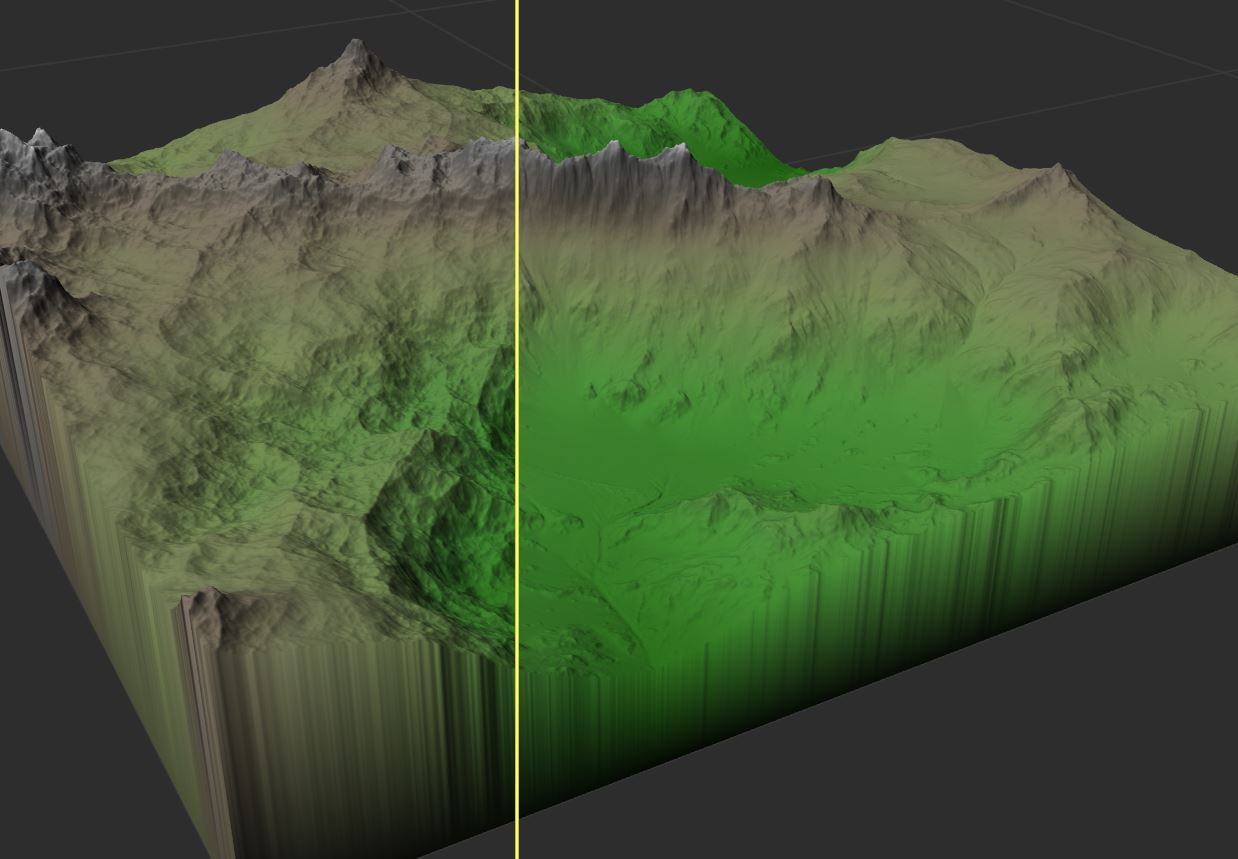
Erosion is also useful for texturing your terrain. By using the masks indicating areas of wear, deposition, and flow, you can create much more interesting terrain textures than a typical height and slope distribution.
Texturing without erosion masks 
Using erosion masks
Device Parameters
There are a large number of parameters in the Erosion device and each parameter can interact with the others to create to a unique effect. Because of this, it is worth your time to experiment either with your own settings or using one of the presets supplied with the device. Dramatically different effects and intensities of erosion can be achieved.
Basic Parameters
These are the most important parameters that you will almost always adjust when adding erosion to a world.
- Erosion Duration
The amount of time to simulate erosion occurring. Higher values will take proportionally longer to process; for good performance use the smallest value that still produces acceptable results. - Rock hardness
How strongly the bedrock resists erosion. Higher values will cause erosion to have less effect overall, but will carve deeper/steeper gullies into the terrain. - Sediment carry amount
The water’s capacity to carry sediment away. Higher values will cause more erosion and also deposit more sediment into valley bottoms. - Filter type
Several types of smoothing can be applied to the terrain during erosion to create different effects:- No Filter – No filtering is performed. This type of erosion tends to have a rough, sharp feel to it.
- Simple Filter – Smoothing is performed. Features are more rounded and diffuse, looking more like soil mantled hillslopes.
- Inverse Filter – Inverse filtering steepens the carved features of the erosion process. This can lead to features that are better suited to ice-carved climates.
- Filter strength
How strongly to apply any filter chosen above.
Geological-time Enhancement
Geological-time Enhancement dramatically increases the extent of the erosion effect without running the simulation for excessively long time periods. With geological enhancement, mountains can be reduced to rubble without waiting an eternity.
- Erosion-time intensifier
Slider to control the intensity of the effect. The lowest setting will produce identical results to non-enhanced erosion; As the value increases the erosion effect is exponentially strengthened. - Reconstruction type:
Governs how to reconcile the extended erosion effects with the starting terrain.- Faster (Linear Ridges) – Fast and produces sharp terrain features but can suffer from axis-aligned terrain shape artifacts.
- Better (Smooth Ridges) – Smoothly blends ancient and recent features, and has far fewer directional artifacts, but is slower to process.
- Uplift
Controls how much geological uplift to apply to the terrain during geological time. On its own, this setting will merely raise the terrain height uniformly. If a mask or water channel input is supplied, this setting comes into its own.
This setting only works while Geological time enhancement is enabled. - Mask Output Structure
This controls how detailed or smooth the erosion texture masks are.
Low values are grainy and only small-scale, while large values average across the entire terrain. This setting only works while Geological time enhancement is enabled.
Channeling Erosion Parameters
These parameters are only used when Channeled Erosion is enabled. Channeled erosion is sometimes useful to help carve distinctive gullies and ridges into the terrain.
- Erosion type
- Standard Erosion produces weathered features without deep gullies.
- Channeled Erosion deepens and carves additional gullies into the terrain.
- Channel depth
How deeply to carve the channels into the terrain. - Post-channeling erosion
Specify a percentage of the total erosion to perform after the channeling action is done. This can make the result look more natural.
Compatibility Options
These options are mostly intended to make Erosion behave similar to previous versions, and can usually be ignored for new worlds.
- Preserve map borders
When checked, erosion will not change terrain that lies upon the map edge. This can interact with the Uplift parameter above, causing the edges to stay where they are while the rest of the terrain is raised: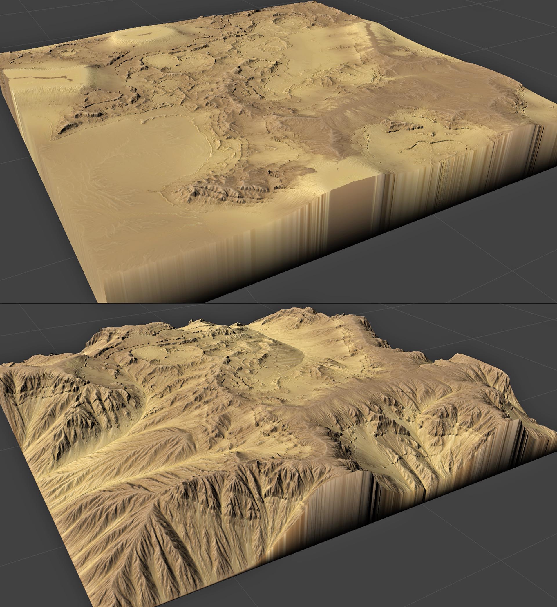
- Hardness doesn’t affect channel depth
When checked, changing the rock hardness won’t change how deeply channeled erosion can bite into the rock. This was the previous default in WM 2.
Input/Output Ports
Besides the usual primary input and output, there are several very useful additional inputs and outputs available with the Erosion device.
Inputs
- Hardness Mask (Heightfield)
Provide a mask that modulates the current “rock hardness” setting. Values of 1.0 will reflect the current rock hardness, while mask values of 0.0 will have the lowest hardness setting. - Water Channel Input (Heightfield or Water datatype)
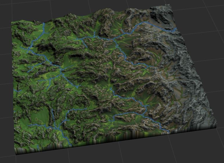
Provide a mask indicating areas of the terrain that contain water channels. These areas will not be eroded, and will serve as “sinks” for the erosion simulation. Read more about how Erosion handles water here.
Outputs
The extra optional outputs are erosion masks indicating areas where the erosion simulation modified the terrain. These are very useful to help drive texturing!
- Flow mask – Indicates areas where water flow has occurred
- Wear mask – Indicates areas where bedrock has been eroded
- Deposition mask – Indicates areas where sediment has been deposited onto the terrain
Erosion and Water Systems
If a water system is supplied, Erosion will use it as a sediment sink. Pre-existing water is assumed to have an infinite capacity to carry sediment away. Because of this, areas near water will erode faster as sediment does not build up and reduce the gradient of the terrain.
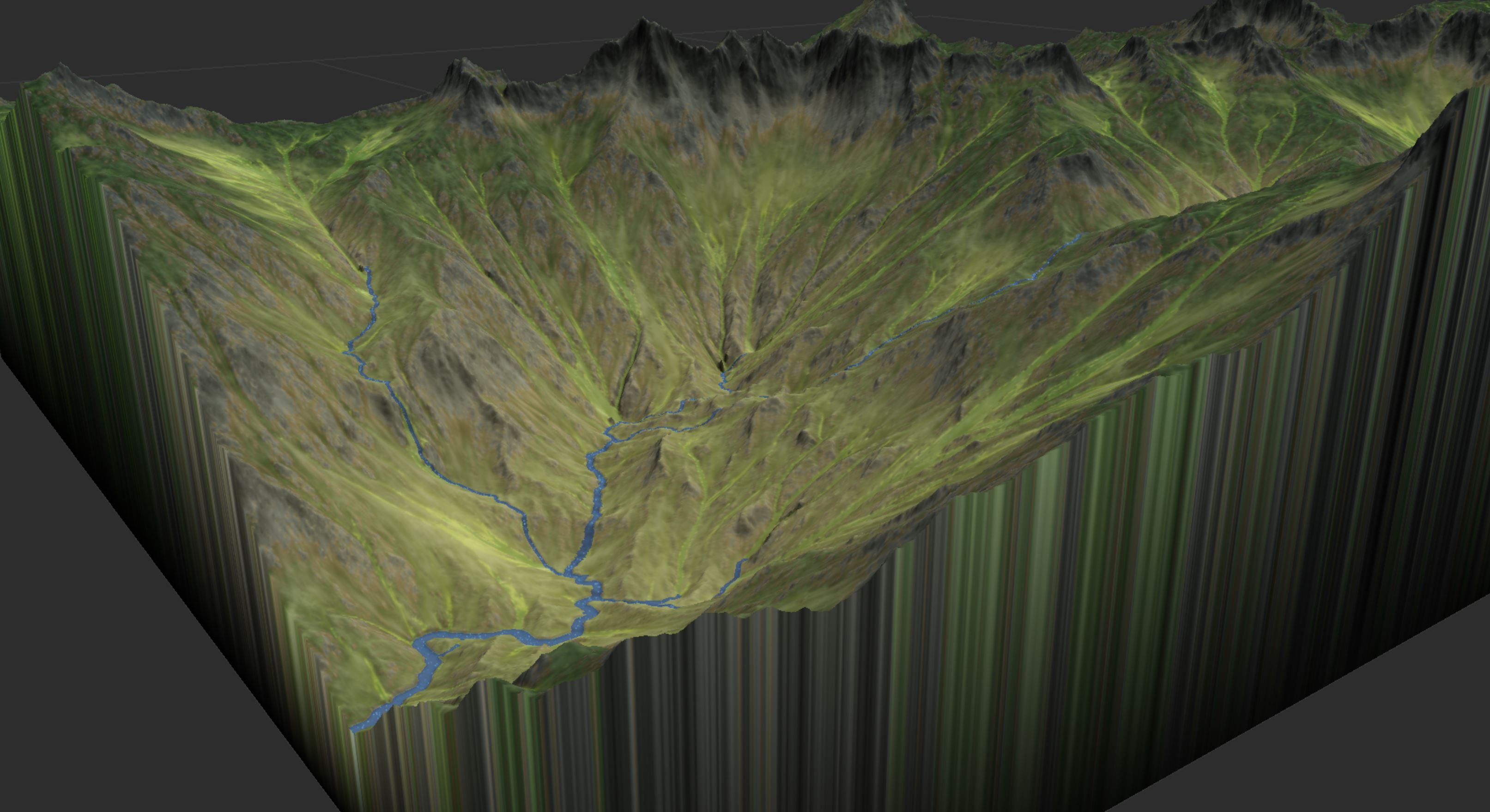
If you perform large amounts of erosion on a terrain with a river system already in place, you will likely want to add Uplift during the erosion process. This provides the forcing function needed to keep the rivers in their proper place at the valley floor.
Best Practices and Caveats
Performance
Erosion is one of the slowest devices in World Machine to process. It is particularly expensive in large world sizes and when water might travel across the entire map. Use the smallest erosion duration that produces an acceptable result, and limit the use of Erosion to only a few places in your network.
Tiled Behavior
Depending on the nature of your world, Erosion may produce different looking results in tiled builds versus a single file build. You can reduce the problematic nature of this by increasing the blending size in your Project Settings -> Tiled Settings.
See Also
- Thermal Weathering
- Texturing
- Water in World Machine
Start the discussion at forum.world-machine.com