Build 3026 is a continuation of the ‘Alpine Lakes’ release of World Machine. Look forward to new features, bugfixes, and usability improvements, especially involving water.
Erosion improvements
Water Input
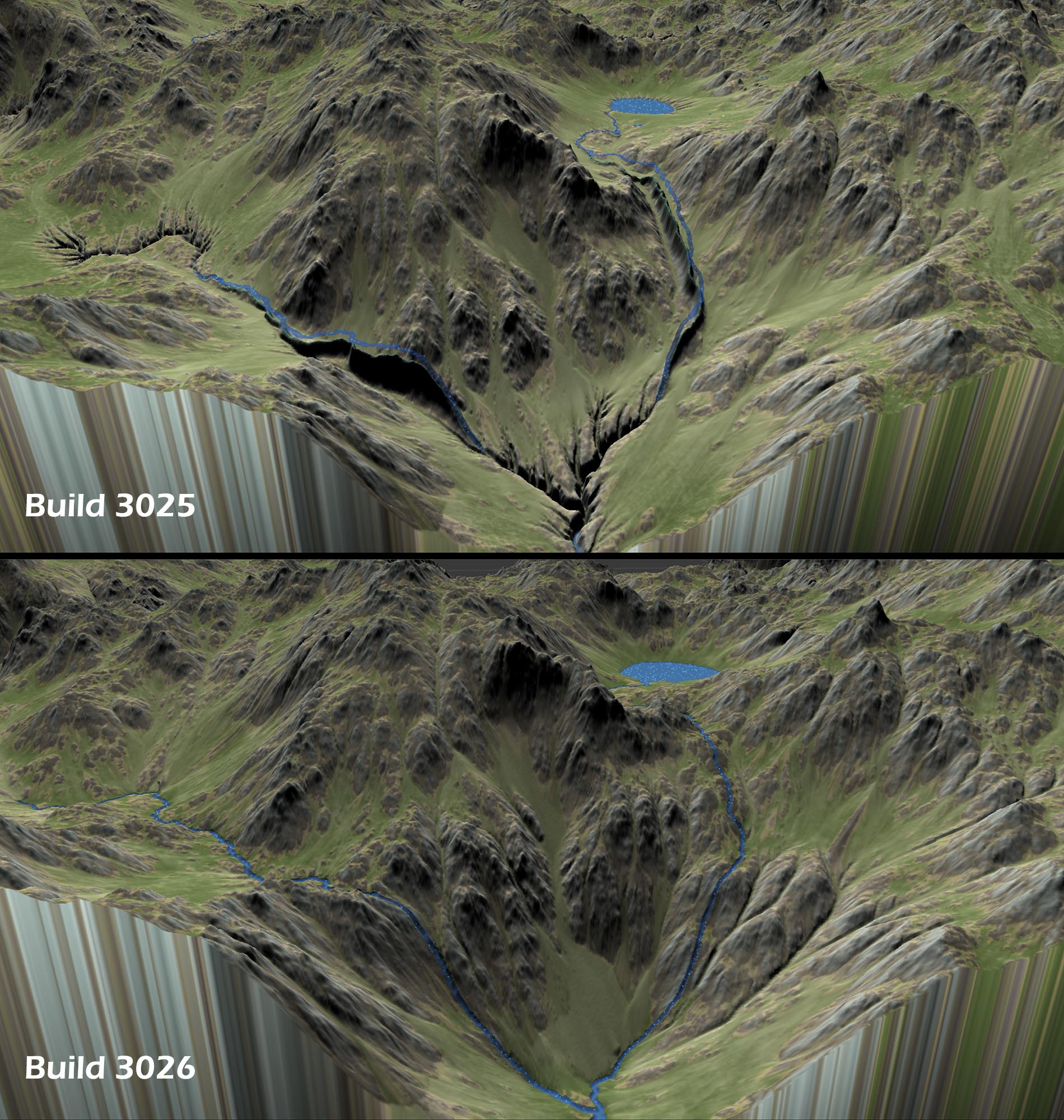
The biggest change is that both regular and thermal erosion have been improved to accept water as an input. When you do this, you can erode directly into the river channels, which will carry the sediment away to the sea.
3026 improves on 3025’s implementation of this:
Dialog Box Tweaks
The dialog box for Erosion has also been updated to be a little cleaner and group controls more logically:
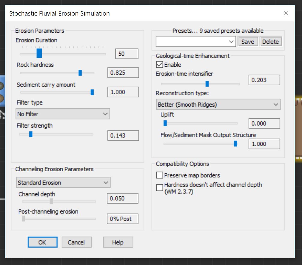
The behavior of Geological-time enhancement has also been changed in 3026 to be a bit more controllable and give a broader range of effect.
Uplift
You now have the option of slowly having the earth raise beneath the terrain undergoing erosion. This provides the forcing function we need to keep the rivers in their proper place at the valley floor.
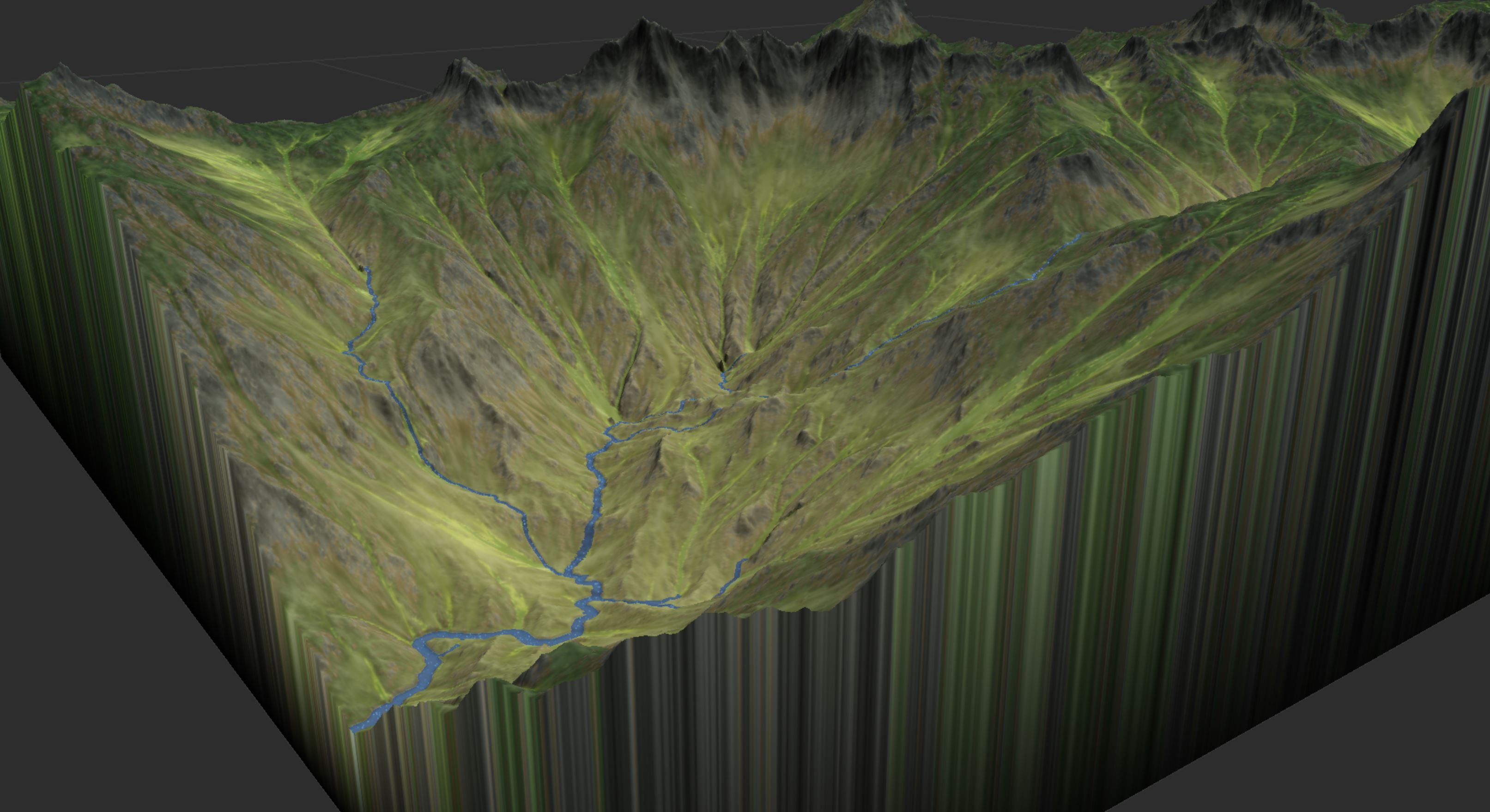
I think you’ll find this to be quite useful!
Preserve Edges
Build 3026 also makes sure the “Preserve Edges” option is
- no longer broken and
- interacts well with uplift.
When enabled, map edges are effectively sediment sinks (just like if you specified a river/sink mask). This lets you carve into the terrain automatically as uplift happens:
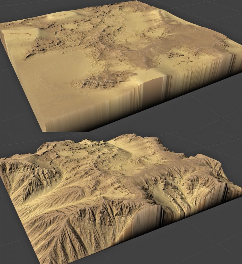
What’s happening in the comparison above is that the edges are being forced to their initial values in the bottom image. This creates the elevation differences that erosion needs to continue working; in the top image, erosion has essentially reached an end-state, where all large structures have been worn away.
Mask Structure
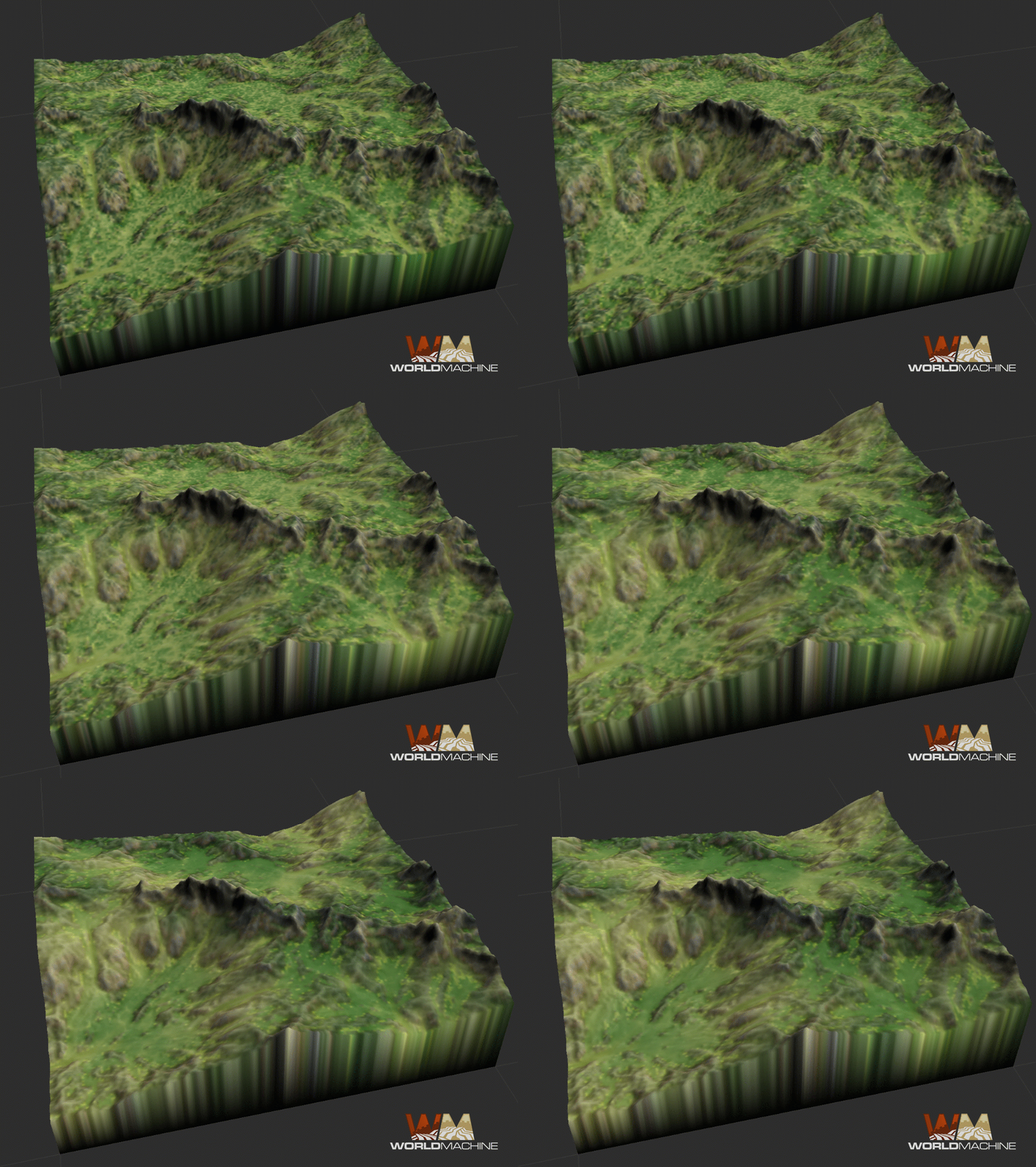
Finally, a new useful control has been added to Erosion: Mask Structure. The wear/sediment/flow masks are incredibly useful for texturing, but getting a good look from them has been counter-intuitive in the past. This has been fixed, and you can now simply set the structure slider lets you control how detailed/smooth you want the mask information to be.
Create Water improvements
Semi-automatic Rivers
Create Water now has a Headwater Locations option. When set to “Specified” instead of “Automatic”, rivers will only be created from locations where you place a pin in the layout view. This gives a very convenient way to run rivers only in certain locations on the map. You can place, move, or delete any of the pins to modify those rivers.
In addition, you can turn the automatic rivers into specified rivers by clicking the “Pin current headwaters” button.
Finally, you can now tell Create Water to drain only to existing water inputs, allowing lakes to form against the map borders.
Layout View improvements
The Layout View now has a “Focus Extents” toggle. When enabled, the Layout View switches from the infinite-extents display to showing only what the current preview does.
This lets you see the true output of your world with no artifacts. Not only does this make devices like Create Water much easier to manipulate, but it also is much faster and more pleasing to work in.
Here’s a video showing this plus the new pinned rivers in action:
There’s also a few other Layout-related improvements:
- You can now view the water geometry properly in the Layout View
- When interacting with the Layout view, WM will decide whether or not to update the preview based on whether it can maintain an interactive (~10fps) screen rate or not.
Other small improvements
- Device versions have a “What’s New” field
- Expander now has a “by pixel” as well as “by meter” mode, like Blur.
- Mesh Output accepts water datatype
- Help buttons now direct you to the help center
- Added log file to assist with troubleshooting program errors
Bugfixes
- Fixed startup crash
- Fixed misc crash
- Fixed curves display bug
- Fixed 3d view immediate response bug
- Fixed layout view UI bugs
- Fixed deadlock threading issue
- Fixed loading old world caused 2 render extents bug
- Fixed erosion masks not looking like previous results bug
- Fixed bug that caused bad river parameters when updating river version
- Fixed bug in tiled file input that prevented relative file paths
